A tornado watch has been issued for southeast Iowa, including Iowa City, until 8 p.m. Central time. This alert indicates that atmospheric conditions are favorable for the development of tornadoes, prompting residents to stay vigilant.
Earlier today, a tornado warning was issued at 2:38 p.m. for northeastern Wayne County, with the warning set to remain in effect until 3:15 p.m. The severe thunderstorm was reported to be moving northeast at a speed of 55 mph, raising concerns about potential tornado activity.
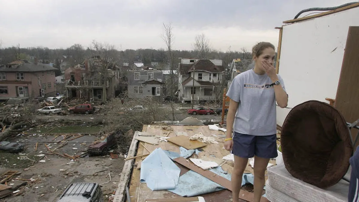
As the storm system progresses, damaging wind gusts, large hail, and isolated tornadoes are possible throughout the afternoon and into the evening hours. The National Weather Service (NWS) in Des Moines has urged residents to “TAKE COVER NOW! Move to a basement or an interior room on the lowest floor of a sturdy building.” This advice is crucial as flying debris can pose a significant danger to those caught without shelter.
Mobile homes are particularly vulnerable during such severe weather events, and residents are advised to seek safer accommodations. The tornado watch encompasses multiple counties in southern and eastern Iowa, highlighting the widespread nature of the threat.
Bill Deger from AccuWeather noted that severe storms today could also impact major cities like Chicago, St. Louis, Detroit, and Indianapolis. As the storms are expected to exit the area around 7-8 p.m., residents should remain alert and prepared for any sudden changes in weather conditions.
Looking ahead, tomorrow has been designated as a weather alert day due to another risk for severe storms, with an enhanced risk level of 3 out of 5. This means that residents should continue to monitor updates from local weather services and be prepared for potential severe weather.
Community members are encouraged to stay informed through reliable sources such as the National Weather Service and local news outlets. The safety of our community is paramount, and being prepared can make all the difference during severe weather events.
Details remain unconfirmed regarding the full extent of the storm’s impact, but officials are closely monitoring the situation and will provide updates as they become available.


