Introduction
Weather radar maps are essential tools for meteorologists and the general public alike. With the increasing frequency of extreme weather events due to climate change, having access to accurate and timely weather information is more important than ever. These maps allow individuals and communities to prepare for storms, heavy rain, and other hazardous conditions, thus saving lives and property.
How Weather Radar Maps Work
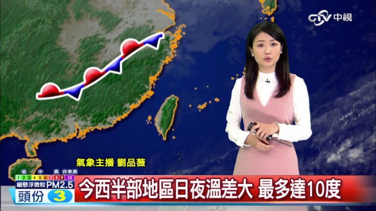
Weather radar systems operate by emitting radio waves that bounce off precipitation particles in the atmosphere. The radar receives the reflected signals, which provide data on precipitation intensity, location, and movement. This information is visualised on radar maps, which indicate areas of rainfall, thunderstorms, and other weather phenomena.
Recent Developments in Weather Radar Technology
Recent advancements in weather radar technology have significantly improved the accuracy of weather forecasts. Doppler radar, for instance, can detect motion, allowing meteorologists to define the speed and direction of weather systems. Meanwhile, dual-polarisation radar provides insights into the size and shape of raindrops, enhancing the understanding of rainfall intensity. These sophisticated systems have led to better early warning systems for severe weather events.
Current Events and Usage
As of October 2023, weather radar maps are increasingly utilized not only by national meteorological services but also by private weather forecasting companies. With ongoing collaboration between facilities worldwide, real-time data sharing has become a standard. For example, recent storms in the UK demonstrate how local authorities are relying on radar maps to make informed decisions about road closings and emergency services. Increased accessibility through mobile applications has also empowered the public to monitor local weather conditions.
Conclusion
In summary, weather radar maps play a pivotal role in modern weather forecasting and public safety. As technology continues to evolve, the efficacy and accuracy of these maps will only get better, enabling better preparedness measures for unpredictable weather patterns. Stakeholders, from government agencies to private companies, must continue to invest in this technology to ensure comprehensive forecasts and safety strategies for the future.