Tornado Watch in Effect
A tornado watch is in effect for the Kansas City metro area until midnight, as severe weather conditions develop across the region. Additionally, a tornado watch has been issued for all of Michiana until 2 a.m. Wednesday, and for several counties in Illinois and Indiana until 11 p.m.
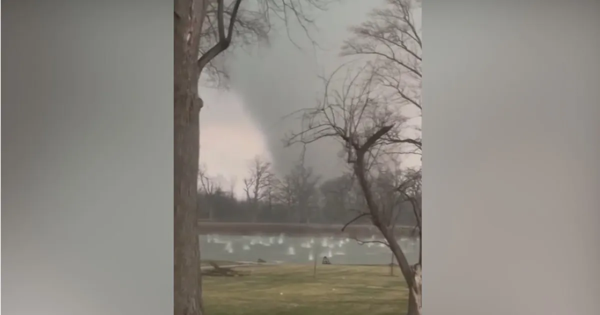
Confirmed tornadoes have already been reported over parts of northwest Indiana, prompting a tornado warning for La Porte County, Indiana, which is in effect until 9 p.m. Furthermore, a severe thunderstorm warning is active for several counties in Illinois and Indiana until midnight.
Severe Weather Threats
Large hail has been reported in Kankakee, Illinois, with measurements reaching as large as 5.2 inches. The entire Chicago area is currently at a high risk for flooding and tornadoes through 1 a.m. Wednesday, with wind gusts potentially reaching 70 miles per hour.
According to meteorologists, “A tornado watch means there are weather conditions that could lead to the formation of severe storms and tornadoes.” CBS News Chicago Chief Meteorologist Albert Ramon emphasized the importance of being prepared, stating, “It is vital that you have multiple ways to receive warnings and be ready to act quickly if a warning is issued.”
Rapidly Developing Storms
Storms are developing quickly across the affected areas, bringing with them the threat of tornadoes and large hail. The main threat associated with the strongest storms includes damaging winds and locally heavy rainfall, which may lead to flash flooding.
The National Weather Service has issued multiple warnings and watches due to these severe weather conditions, urging residents to stay alert and take necessary precautions.
Details remain unconfirmed as the situation evolves, and residents are advised to monitor local weather updates closely.


