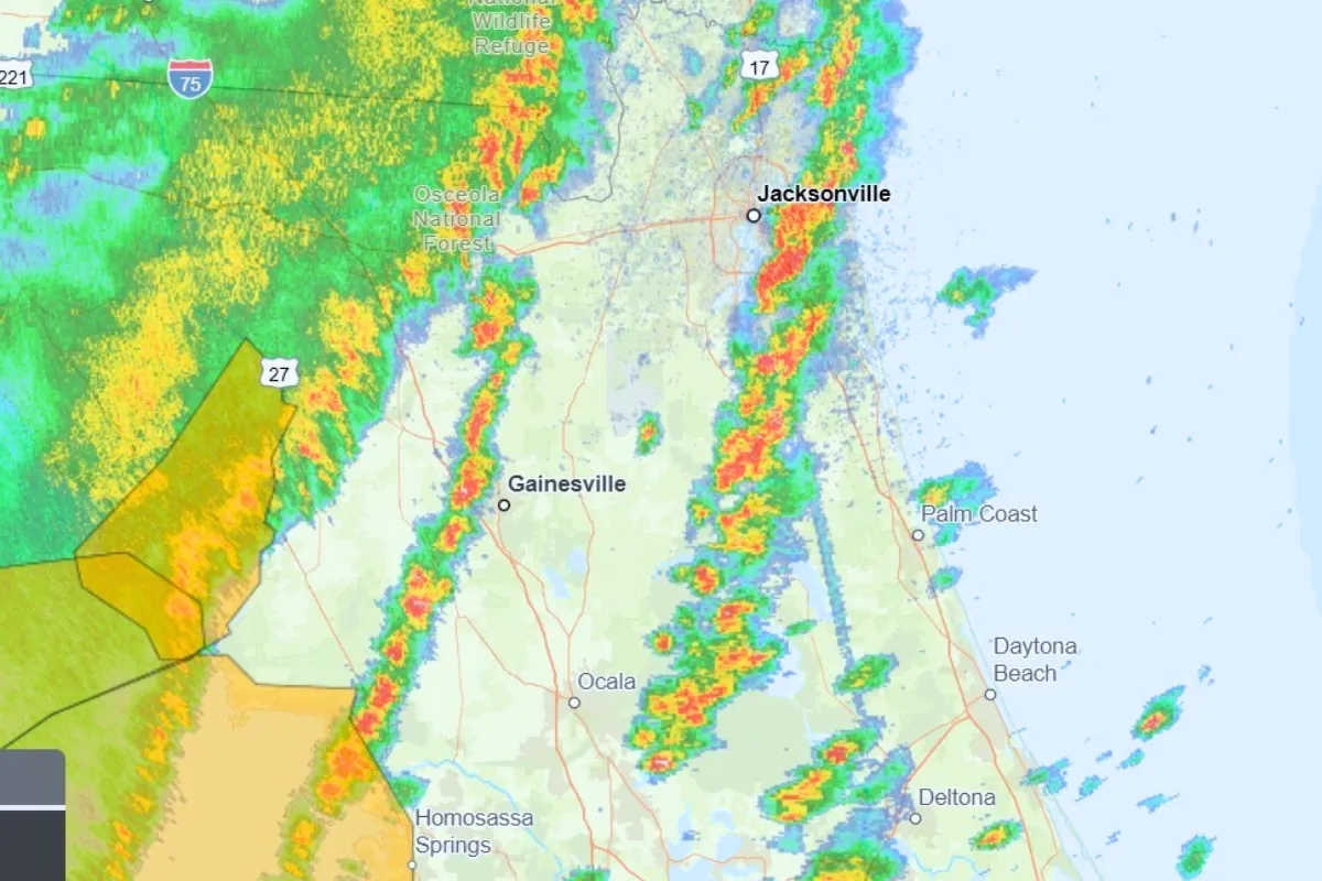
A tornado watch has been issued for Jacksonville and surrounding areas, raising concerns about severe weather conditions. This watch, which includes Alachua, Bradford, Marion, and Union counties, is expected to remain in effect until 8 p.m.
The National Weather Service is actively tracking a line of strong thunderstorms moving at approximately 50 miles per hour. These storms are significant as they bring much-needed rain to the region, which is currently experiencing a severe drought.
As the storms approach, overnight temperatures are predicted to drop to around 39 degrees, adding to the potential hazards associated with the severe weather.
In a related event, an EF0 tornado was confirmed to have struck the Sugar Creek area in northeast Charlotte, with winds reaching up to 85 mph and extending half a mile in length. This incident is part of a broader pattern, as five tornadoes were confirmed last week in North Carolina, including one EF0 tornado in Jacksonville, NC.
The issuance of a tornado watch serves as a crucial alert for residents, indicating the possibility of tornado formation. It is important for individuals in the affected areas to stay informed and prepared as conditions evolve.
Details remain unconfirmed regarding any potential impacts from the storms currently moving through Jacksonville. Residents are advised to monitor local news sources and the National Weather Service for updates on the situation.


