Current Weather Situation
A combination of cooling temperatures in the 40s throughout the metro area and warming temperatures close to 80 degrees south of Interstate 80 is expected to create clashing air masses that will bring the worst of the storm south of the interstate, including the threat of tornadoes.
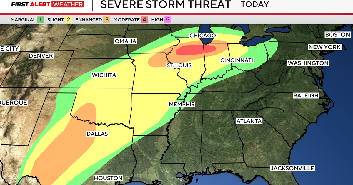
A powerful storm system brought severe weather to the Chicago area late Tuesday afternoon with large hail, damaging winds, and rainfall. The Storm Prediction Center placed southern portions of the Chicagoland area under a Moderate Risk for severe weather, which is Level 4 out of 5.
Severe Weather Threat
A severe storm threat looms late into the night Tuesday and into Wednesday morning. A Flood Watch remains in effect through 3 a.m. for much of the area, with widespread flooding likely this evening. The threat of severe storms brings potential hail and tornadoes.
Storms could begin sometime between 3 p.m. and 5 p.m. and linger into early tomorrow. The risk of a tornado is ‘significantly lesser’ in the metro area, but a ‘decent amount’ of rainfall and some hail is likely in parts of the city.
Forecast and Reactions
Kevin Doom, a meteorologist, stated, “We could still see some relatively stronger, probably more scattered, thunderstorm coverage through the overnight, but it looks like the primary severe threat into the city is probably going to wrap up around midnight or shortly thereafter.” The primary severe threat is expected to diminish after midnight.
Looking ahead, the high temperature for Wednesday is forecasted to be 42 degrees, with a low of 30 degrees. For Thursday, temperatures are expected to reach a high of 48 degrees and a low of 40 degrees. On Friday, the high will be 49 degrees with a low of 30 degrees, and Saturday is expected to have a high of 44 degrees and a low of 37 degrees.


